 |
| Me on the Map geography project…. |
I start the geography unit by showing this fun Harlem Globe Trotter movie. HERE at TV411. Some games we do this week in computer lab are HERE at Reach the World and TRAVELPOD. Both are fun geography skill games.
 |
| Zach on the map…. |
This was a major project we did in our class to teach GEOGRAPHY and all the vocabulary of the oceans, continents, countries, states, towns, cities and streets for all of us. We started by reading the story, “ME ON THE MAP” And I had a list of Geography books too.

Books that I read include:
Me on the Map by: Joan Sweeny
Our Earth by Anne Rockwell
The Nystrom Nystronaut Atlas for Kids (A great resource for a mapping unit)
 |
I bought a class set of these children’s atlases a few years back….best money I’ve spent! Find them on Amazon
for $3.00 each. You can get 10 delivered for $30.00 including shipping…. |
We read about 4 pages every day of the atlas as it coincided with our town, city, state discussions. I only have a 1/2 class set as they are rather expensive but I LOVE them and would buy them again.
 |
| Hey! Did we make a stopover in Hawaii? I like that place! |
Another link has a flags of the world match card game in color that is really cute and fun. The LINK is HERE at Homeschool Creations. I thought of adding flags to this project but it was already so involved, I’ll save that for another year when I’ve got the basics down and have extra time. A cute map of the world with a word search and continent questions I used is found HERE at tls books.
The Webquest for Geography I will use is at this LINK HERE at Web Mac. This had lots of great info that the kids could check out in the computer lab.
Crossword puzzles I used for each of the continents was HERE at Mac.com. This I used as an extra at another time during the day when we were done with our writing and map booklets.So HERE was the Art/Map project we did.
 |
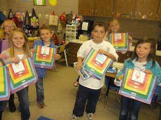
| Finished Me on the Map Projects… |
TAGS FOR EACH PAGE HERE. I found outline political maps at this website HERE at the Teacher Corner. A map of Antarctica I found HERE at factmonster . A few free maps of several continents I found HERE at Superteacher Worksheets. And HERE at Round Valley Schools are some great maps for a unit on the continents and oceans too.
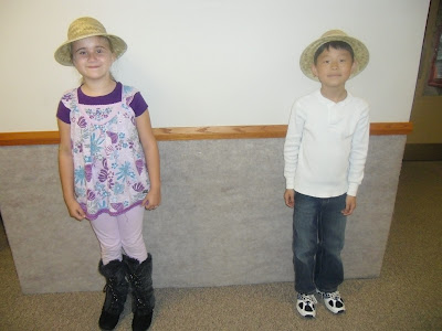
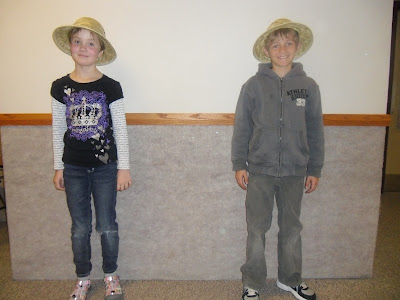
We also wrote about each of the 7 continents in my class as part of our STUDENT TREASURES BOUND BOOKS PROGRAM. I then took their pictures with safari hats, shrunk them down to 2 x 2 size and had them color pictures of the maps and added their little photog’d selves in their safari hats to the maps. Super cute. I’ll post that project when it comes back from the publishers.
 |
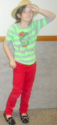
| Posing in our safari hats…. |
 |
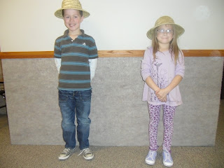
| Do they LOOK excited to be traveling around the world? hmmmm…. |
 |
| Did you guys like traveling on the Orient Express across Asia? |
 |
| Where in the world is…..Matt and Saige? |
 |
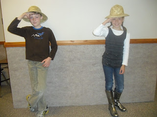
| I think they got stuck on a submarine in Antarctica….that’s what I heard…. |
 |
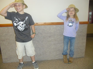
| Did you girls have fun in the Amazon? Or did you like the Sahara desert better? |
 |
| That helicopter ride over the Mediterranean? Yeah that was pretty cool! |
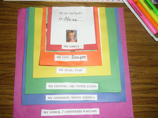
1. First we did a 4 inch white square with “ME ON MY STREET” and had our street names and addresses if we knew them. We drew a black street with yellow lines on it and our house with our dog a tree and a picture of us next to our house. Then we colored it and then backed it with a 5 inch RED SQUARE for color.
 |
| Me on My Street…. |
 |
| We tried to add house numbers….some kids had just moved and didn’t know them yet… |
 |
| But I think that is important to learn their street number and name…. |
2. Second we did a 5 inch white square with “ME IN MY CITY of SALT LAKE” and did a picture of
a criss cross black street with yellow lines. Then on either side of the criss cross street we made buildings and listed our favorite restaurants, stores, movies, pet shops, police station and fire station. Then we colored them different colors and put ourselves near our favorite place to go in our city. Some kids had skate shops and libraries. We backed it with a 6 1/2 inch ORANGE SQUARE.
 |
| Then we did cityscapes of our favorite stores in our city…. |
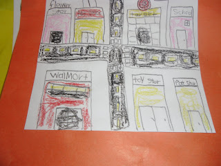 |
| McDonalds and Walmart were big time favorites… |
I have floor puzzles I bring out this week for a geography center. Kids love these giant floor puzzles and I always hear lots of discussion because this one has pictures of what things are found on that continent or state.
 |
| The kids will remember cities….where we shop, eat and play…. |
 |
| Yup, gotta love the golden arches of McDonalds…favorite places in our city! |
3. Third we made a 6 inch white square with “ME IN MY STATE of UTAH” and did a picture outline of the State of Utah with the Great Salt Lake, Lake Powell, and a star with our capital city of Salt Lake.
Then we colored that in and had us standing next to the state in cowboy hats or baseball hats. We backed it with a 8 inch YELLOW SQUARE.
 |
| Lucky for us our state of Utah is very easy to draw! |
 |
| We added the Great Salt Lake, the capital (Salt Lake City) Lake Powell and the Colorado River…. |
 |
| We all thought Lake Powell was soooooo important….snicker….Love that place! |
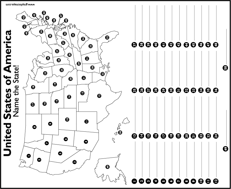
4. Fourth we made a 8 1/2 inch white square with “ME IN MY COUNTRY, U.S.A.” and I copied a blackline and shrunk it of a U.S.A. Map. We backed it with a 9 1/2 inch GREEN SQUARE. HERE is a U.S. Map Blackline for Free. It has a number for all the states and then a line underneath to write the names of the states. It is a fun activity for kids to help each other in cooperative groups to fill in all 50 of the United States. We will be using this one in my class. THIS IS THE MAP WE USED. I shrunk it down 10 %.
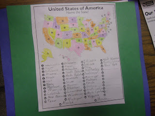 |
| Our country the good old U.S.A. We listed all the states we could…. |
 |
| This was a very fun activity…. |
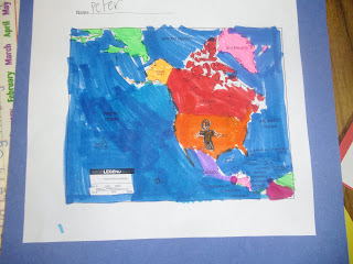
5. Fifth we made a 9 inch white square with “ME ON MY CONTINENT, NORTH AMERICA” with a map of North America and we colored in the different countries; Mexico, Canada, USA and Greenland all different colors. We backed it with an 11 inch BLUE SQUARE.
 |
| Our continent….North America…. |
 |
| We glued everything with a border around 3 sides, but flush with the top…no border…. |
 |
| Me on My Continent…we listed Me on My…on every page we did…. |
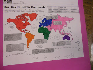
6. Sixth, and lastly, we made an 10 1/2 inch white square with “ME IN MY WORLD, THE PLANET EARTH”and I copied and shrunk a blackline of the world’s continents. We colored them 7 different colors and the water blue and had the oceans labeled. We backed it with a 12 inch PURPLE SQUARE. This link is a great one for copying simple maps of the countries of each continent. HERE at eduplace is the link.
 |
| Me in My World….The Planet Earth…. |
 |
I did 2 styles of these…one for the rotation on the bottom includes a word bank. The top one they
have to come up with the continents AND oceans on their own with just a beginning letter….One was more challenging than the other. One was for my test to see if my kids learned all 7 continents and all 4 oceans. |
 |
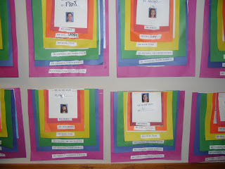
Then we stapled them all together….Finished Mapping Activity – Continents, Countries, Cities and States….
You’ll notice there is no border on the top of each page….we kept that flush so the colorful parts would not
get obstructed by white papers from each section…..I think that looks nicer…. |
Me on the Map Geography Activity….What do you think? I think the kids learned a lot about their world….
 |
| And I did a LOT of paper cutting…..snicker….. |
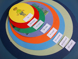 |
| Here was my inspiration…a project I saw on Pinterest…..Here is one on 365 Day of Pinterest Creations |
The reason I did squares instead of circles or ovals like others did was simply because it would be easier to cut on a paper cutter and measure and I did it for a 2nd grade rotation so I had 100 kids to do it with. I’d go absolutely crazy cutting out that many circles….EEK!
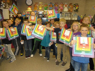 |
| Here was my rotation class with their finished map project….Me on the Map! |
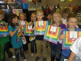 |
| I think they were very proud of their work…. |
 |
| I hope they learned more than just “NEVER EAT SOGGY WAFFLES…NORTH, SOUTH , EAST, WEST”….. |
 |
I updated the captions to include the names of the states, continents and country we live in…so kids
would always remember them and not get mixed up on the vocabulary. |
I think it turned out just as nice. And very colorful with the rainbow order of papers. What do you think?


